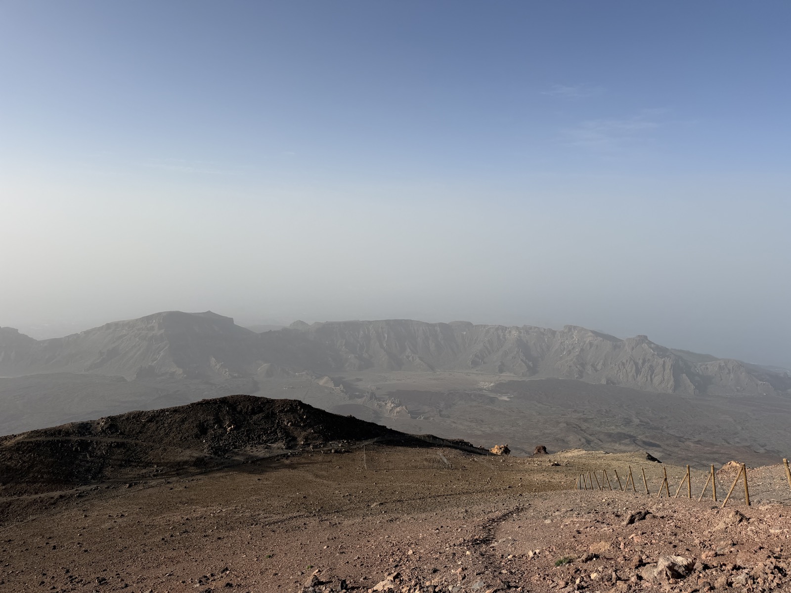
Teide National Park: A Complete First-Timer's Guide
Teide National Park is not a viewpoint you tick off on a drive round Tenerife — it is a 2,000-metre-high volcanic world with its own weather, its own light and, since January 2026, its own entry fee for the summit trails. I climbed to the crater on foot in July 2026, starting in the dark and watching sunrise from above the clouds, and the single biggest lesson was this: the park rewards people who arrive with a plan. This guide is that plan.
What the park actually is
The numbers first, because they frame everything else. Teide National Park sits at roughly 2,000–2,400 m altitude in the centre of Tenerife, wrapped around two things: the Las Cañadas caldera, a vast eroded amphitheatre about 16 km across at its widest, and Pico del Teide itself, the stratovolcano that grew out of it. The summit stands at 3,715 m — Spain’s highest point (you’ll still see 3,718 m on older signs and some operator websites; the Instituto Geográfico Nacional’s figure is 3,715 m). Measured from the ocean floor, the whole edifice is over 7 km tall, which is why UNESCO inscribed the park as a World Heritage Site in 2007.
It is also the most-visited national park in Spain — well over four million visitors a year, with 2024’s record count topping five million. That pressure is exactly why the access rules keep changing (more below). The reassuring part: entry is free, the roads are public, and you can drive in, park at the miradors and walk most trails without booking anything. Only the summit trails and the cable car cost money or need reservations.
The park is high desert, not mountain meadow. Expect fierce sun, air noticeably thinner than at the coast, and temperature swings of 15°C or more between the beach and the caldera. In July I left a 24°C evening in the resort and was wearing gloves at La Rambleta before dawn.
The geology, in plain English
Tenerife is the tip of a huge volcanic pile, and the park is its most recent chapter. Around 170,000–200,000 years ago the top of the older volcano collapsed — a mix of caldera collapse and gigantic landslides towards the north coast — leaving the semicircular wall of cliffs you see today. Those cliffs are the caldera rim: up to about 600 m high, topped by Guajara (2,715 m) opposite the Parador. Teide and its neighbour Pico Viejo (3,135 m, with a crater roughly 800 m across) then grew inside the scar.
What you’ll actually see on the ground:
- Black glassy lava tongues running down from Montaña Blanca — obsidian-rich flows so fresh-looking they seem wet. The rounded boulders on its slopes, the Huevos del Teide (“Teide’s eggs”), are accretion balls that rolled down still-molten lava.
- Rough, clinkery ʻaʻā lava and smoother ropy pāhoehoe side by side along TF-21 — once you know the two textures you’ll spot them everywhere.
- Orange and rust-red rock near the summit cone — older lavas oxidised by hot, acidic gases escaping through the rock.
- Fumaroles at the crater — thin wisps of steam that smell unmistakably of sulphur. At sunrise the warm vents are strangely welcome at 3,700 m.
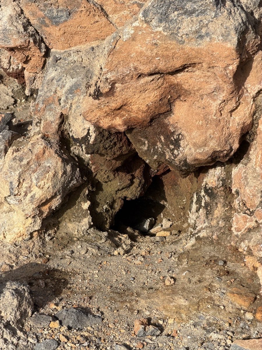 The oxidised, rust-orange rock near the summit — stained by decades of sulphurous gas seeping through the cone.
None of this is ancient history. The last eruption inside the park was in 1798 at Narices del Teide (“Teide’s nostrils”) on Pico Viejo’s flank — the black flows are clearly visible from the TF-38. The last on Tenerife was Chinyero in 1909, just outside the park boundary. Teide is dormant, constantly monitored, and safe to visit.
Key stops: a one-day itinerary along the TF-21
Three roads climb into the park: the TF-21 from La Orotava in the north and Vilaflor in the south, the TF-24 from La Laguna along the island’s spine, and the TF-38 from Chío in the west. The TF-21 is the park’s main street, and almost everything worth stopping for sits along it. Driven north to south, this is the day I’d give a first-timer:
| Stop | Where | Time | Why |
|---|---|---|---|
| El Portillo visitor centre | TF-21, northern entrance | 30–45 min | Exhibits on the park’s formation plus a botanical garden of native flora — the quickest way to learn what you’re looking at. Typically open from 9:00; check locally. |
| Minas de San José | TF-21, south of El Portillo | 20 min | Rolling fields of pale pumice that look genuinely lunar — this is where crews filmed “alien planet” scenes. Park only in the lay-bys. |
| Montaña Blanca trailhead | TF-21 km 40.2 | 5 min (or all day) | The start of trail no. 7, the classic on-foot route up Teide. Even a 20-minute walk up the track gets you among the black obsidian flows. |
| Cable car base station | TF-21, 2,356 m | 2–3 hrs with the ride | The eight-minute ride to La Rambleta (3,555 m) and the short walks to the Pico Viejo and Fortaleza viewpoints. Book ahead — see below. |
| Roques de García & Mirador de Ucanca | TF-21, opposite the Parador | 1.5–2 hrs | Trail no. 3, a 3.6 km loop around the famous rock spires (including the much-photographed Roque Cinchado) with views over the Ucanca plain. The full loop drops below the rocks and climbs back up — save it for before the midday heat. |
| Parador area | Same car park | 30 min | Coffee or lunch stop, and the best straight-on view of Teide reflected against the caldera wall. |
| Boca Tauce | TF-21/TF-38 junction | 10 min | The 1798 lava flows from Narices del Teide, draped down Pico Viejo’s flank. Exit west here towards Chío, or south towards Vilaflor. |
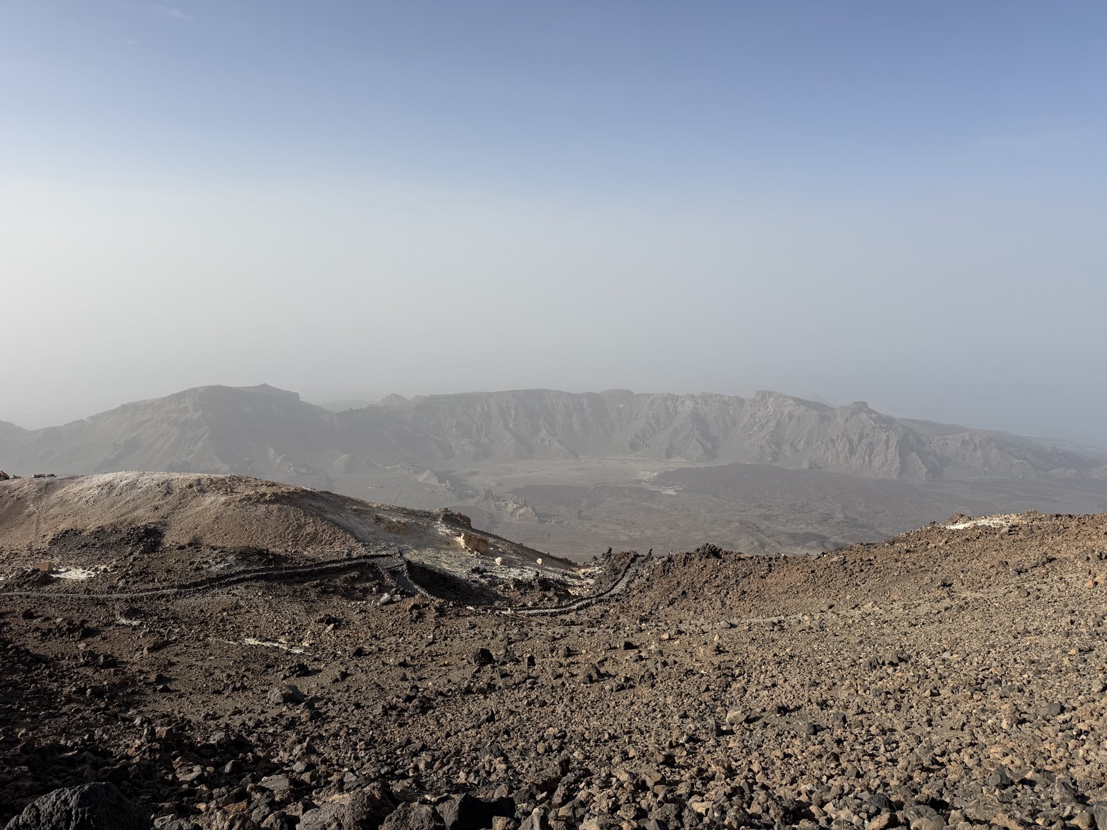 Looking back across the caldera from the upper mountain — the TF-21 is the thin line threading between the lava fields.
If you only have half a day, cut it to three stops: cable car, Roques de García, and whichever mirador is on your route out.
The 2026 access rules — what actually changed
This is where most out-of-date guides will mislead you, so here is the position as of July 2026. Tenerife has been overhauling how visitors access the park under its “Teide Access” visitor-management project, and the practical changes landed in stages between late 2024 and early 2026:
- All hiking permits now go through Tenerife ON, the island’s official booking platform. The old system on reservasparquesnacionales.es no longer handles Teide summit permits. You need to register a free account, and you must carry ID matching the booking — wardens on the mountain do check.
- Trail no. 10 (Telesforo Bravo) — the final 160 m of ascent from La Rambleta to the crater — remains strictly limited, currently around 200 people per day split across four time slots. Since 19 January 2026 it also carries a fee for most visitors: free for Tenerife residents and under-14s, €6 for residents of the other Canary Islands, and €15 for everyone else (slightly less if you go as part of a licensed guided tour).
- Trail no. 7 (Montaña Blanca–La Rambleta) has needed authorisation since November 2024, and since 19 January 2026 it carries its own, lower ecotax: still free for Tenerife residents, but for everyone else the fee is cheaper than trail 10 and varies by day — roughly €3–5 for other Canary residents and €6–10 for non-residents, weekends dearer than weekdays. The other high-mountain ascent routes on the cone (trails 9, 23 and 28) are also permit-only.
- Everything else is still free and booking-free — under temporary measures currently confirmed until 31 December 2026, all other park trails (including the Roques de García loop) can be walked without any reservation. That may change from 2027 as the Teide Access project rolls on, so check Tenerife ON shortly before you travel.
Slots for the summit trails open on a rolling 56-day window, with a new week released every Monday at 07:00 Canary time. In high season the free-standing slots go fast; if you can’t get one, a guided summit tour with the permit included is the standard workaround — see the full walkthrough in our summit permit guide, or browse summit tours and cable car packages.
One more 2026 change worth knowing: the Refugio de Altavista at 3,260 m on the Montaña Blanca route reopened on 20 July 2026 after five years closed and a €1.9 million refurbishment. It now has 49 beds, a one-night maximum stay, and launch prices from €29 for Tenerife residents and €71 for other visitors, booked online. Sleeping there turns the summit climb into a civilised two-day outing — details in our hiking guide.
Park rules (they are enforced)
The rules are simple and the wardens are not shy about applying them:
- Stay on marked trails. The pumice fields scar for decades; a single shortcut stays visible for years.
- Take nothing. No stones, no plants, no “just one small piece of obsidian”. Bags do get checked.
- No rock stacking. Those little towers destroy invertebrate habitat and are actively dismantled by staff. Don’t add to them.
- No drones without a specific filming permit — recreational flying is prohibited throughout the park.
- No wild camping or overnight parking, and no smoking or fires outside designated areas. The only legal way to sleep high on the mountain is the Altavista refuge.
Flora and fauna worth knowing
The park looks barren from a car window and absolutely isn’t. Some 168 plant species grow here, a third of them found nowhere else on Earth. Four to look for:
- Tajinaste rojo (Echium wildpretii) — the two-metre spike of crimson flowers on every Tenerife postcard. It blooms roughly May to June; by late July, when I was there, most spikes had gone to bronze seed heads, still photogenic in their own right.
- Teide white broom (retama) — the rounded shrubs that fill the caldera, fragrant with white-pink blossom in late spring.
- Teide violet — a tiny purple flower that grows higher than any other plant in Spain, right up among the summit scree. Look, don’t touch: it’s strictly protected.
- Teide daisy and flixweed colonising the newest lava — plant succession happening in front of you.
For fauna, the reliable sightings are Canarian lizards (males with blue flank spots) basking at every mirador, kestrels hovering over the retama, and ravens riding the rim thermals. After dark the sky itself is the wildlife: Tenerife is a certified Starlight destination, and the stargazing here is the best in Spain.
Eating, fuel and other practicalities
Plan like you’re crossing a small desert, because you are:
- There are no petrol stations inside the park. Fill up in Vilaflor, La Orotava or Chío on the way in. There are no shops either.
- Food options are exactly three: the Parador’s restaurant and café by Roques de García, the cafeteria at the cable car base station, and a couple of simple roadside restaurants near the El Portillo junction. All get busy 13:00–15:00. Carrying your own water is non-negotiable — a litre per person minimum, double if you’re hiking.
- By bus: Titsa runs one bus a day each way on two lines. The 342 from Costa Adeje leaves at 9:25 and starts back from El Portillo at 15:15 (Parador stop 15:40); the 348 from Puerto de la Cruz leaves at 9:30 and returns from the Parador at 16:00 (Teleférico 16:05). Miss the return bus and you are hitch-hiking. Timetables do shift, so re-check titsa.com for current times and fares the day before.
- By car: 1.5–2 hours from the southern resorts, about an hour from Puerto de la Cruz. Car parks at the cable car and Roques de García overflow from mid-morning in season — arrive before 9:30 or after 15:00. Full route-by-route detail is in our getting to Teide guide.
- The cable car costs €42 return for non-resident adults and €21 for children aged 3–13 at the time of writing, running from 9:00 with a last ascent of 17:40 in high summer (16:00 much of the rest of the year) — confirm current prices and hours on volcanoteide.com. It closes for wind surprisingly often, so build in a plan B. Our cable car guide covers tickets, queues and the viewpoint walks at the top.
- Altitude is real. La Rambleta is 3,555 m; expect breathlessness, a possible headache, and sunburn through thin air. The operator does not allow pregnant women or people with serious heart or respiratory conditions on the cable car at all — it publishes the full list of restrictions.
- The Teide Observatory at Izaña (2,390 m, on the TF-24) — the world’s largest solar observatory — runs guided daytime tours most days, bookable through Volcano Teide. Children under 8 aren’t admitted on the standard tour (a separate family version takes ages 5 and up). It’s a worthwhile add-on if you’re driving the TF-24 corridor anyway.
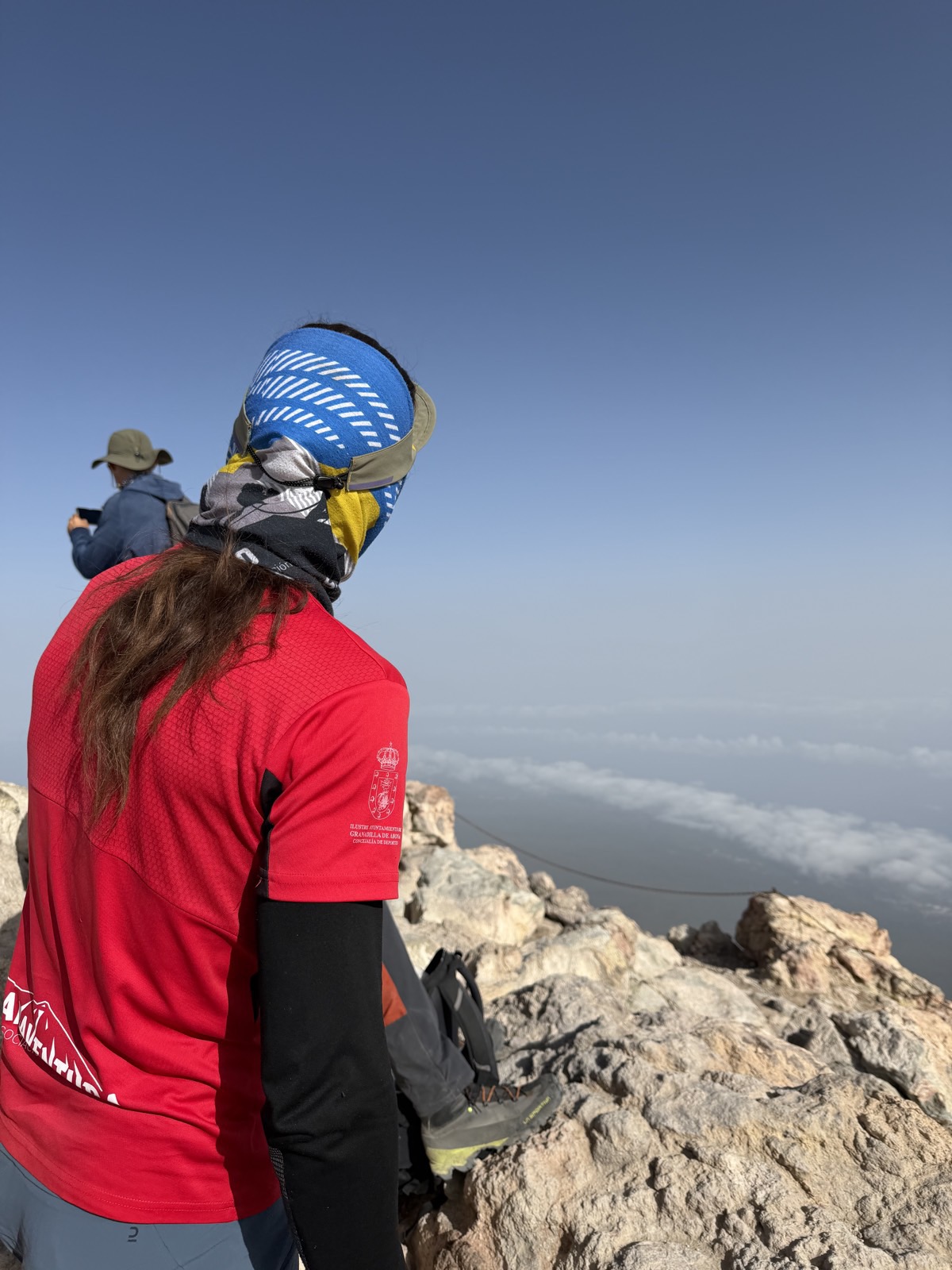 Above the cloud sea on the upper mountain. The trade-wind clouds usually sit at 1,000–1,500 m — the park floats above them.
How to combine it all
For most first-timers the winning formula is simple: cable car up in the morning, Roques de García loop after lunch. You get the summit-zone views without a permit, the park’s most famous rock formations, and you’re back at the coast for dinner. Book the cable car a few days ahead and you’ve removed the only real queue of the day.
Upgrades on that formula, roughly in order of effort:
- Add the crater. Book trail 10 through Tenerife ON (or a guided tour with the permit handled) and turn the cable car trip into a genuine summit.
- Stay for sunset and stars. The light on the caldera in the last hour of the day is extraordinary, and the park after dark is a different place entirely.
- Climb the whole thing. Montaña Blanca to the crater, ideally with a night at the reopened Altavista refuge and a pre-dawn finish. Watching the sun rise over the cloud sea from the crater rim is the single best thing I’ve done in the Canaries.
Whichever version you choose, the park punishes improvisation and rewards booking ahead. Sort the permits, fill the tank, pack the fleece — then let the mountain do the rest.
Frequently asked questions
Do you have to pay to enter Teide National Park?
No. Entry to the park is free, the roads through it are public, and there is no gate or general reservation to visit. What costs money: the cable car (€42 return for non-resident adults at the time of writing), the new ecotax on the summit hiking trails introduced in January 2026 (€15 for most visitors on trail 10, free for Tenerife residents), and optional extras like guided tours or the Altavista refuge.
Do I need a permit just to visit the park or ride the cable car?
No. Permits are only required for the high-mountain trails on Teide’s cone — trail 10 (Telesforo Bravo, the final stretch to the crater), trail 7 (Montaña Blanca) and trails 9, 23 and 28. The cable car, the miradors, Roques de García and the park’s other trails currently need no authorisation, though cable car tickets should be booked online ahead to skip sold-out slots.
How high is Mount Teide?
The summit is 3,715 m above sea level according to Spain’s Instituto Geográfico Nacional, making it the highest point in Spain — you’ll also see the older figure of 3,718 m on signs and some websites. Measured from its base on the Atlantic seabed, the volcano stands over 7,000 m tall. The cable car’s upper station sits at 3,555 m, and the base station at 2,356 m.
Is the Altavista refuge open in 2026?
Yes — finally. The Refugio de Altavista (3,260 m) reopened on 20 July 2026 after five years closed and a €1.9 million refurbishment. It offers 49 beds with a maximum stay of one night, at launch prices from €29 a night for Tenerife residents and €71 for other visitors, booked through the refuge’s official online system. Demand for summer and autumn dates is predictably heavy, so book early.
Can you drive through the park at night?
Yes. The TF-21, TF-24 and TF-38 are public roads and stay open around the clock, which is exactly how stargazers and sunrise photographers use them. The exception is winter weather: after snow or ice the Cabildo closes access roads at short notice, sometimes for days. Check road status before driving up between December and March, and never park overnight to sleep in the car — that counts as camping and is prohibited.
How long do you need in Teide National Park?
A well-planned full day covers the classic circuit: a visitor centre, the cable car, Roques de García and two or three miradors. Half a day works if you limit yourself to the cable car plus one stop. Hiking to the summit on foot is a full day on its own (9–11 hours return), or a more relaxed two days with a night at Altavista. Photographers and stargazers should stay for sunset — the crowds vanish and the light gets better.
Will I feel the altitude?
Probably, mildly. The caldera floor at ~2,100 m is fine for almost everyone, but the jump to La Rambleta (3,555 m) commonly brings breathlessness, a faster pulse and sometimes a headache — you’ve gone from sea level to serious altitude in a couple of hours. Walk slowly at the top, drink water, and skip the trip if you’re pregnant or have significant heart or lung conditions. Children under 3 aren’t allowed on the cable car ascent.
When does the tajinaste bloom?
The famous red tajinaste spikes flower from roughly May to mid-June, with the best displays usually in late May — that’s also peak season for wildflowers across the caldera. By July the spikes have dried to rust-coloured seed heads. If the bloom matters to you, aim for the second half of May, when settled weather and flowering usually overlap.